 | Edmund Bailey O'Callaghan - 1882 - 608 pagina’s
...(less Vol. 1). 7 vols, 18mo, half roan Paris, 1829 -x^-i 1563 MOLL, H. A New Map of the North Part of America / claimed by France under ye names of Louisiana, Mississipi, Canada and New France, &c. Mounted on linen and folded in cover. 8vo 1 720 1564 MONETTE, JW History of the Discovery and Settle-... | |
 | Justin Winsor - 1887 - 390 pagina’s
...his New Map of the North Parts of America claimed by France under the name of Louisiana, Mississippi, Canada, and New France, with the adjoining territories of England and Spain (measuring 24 X 40 inches), he said that a great part of it was taken from " the original draughts... | |
 | Andrew McFarland Davis - 1887 - 104 pagina’s
...Neiu Map of the North Parts of America claimed by France under the name of Louisiana, Mississippi, Canada, and New France, .with the adjoining territories of England and Spain (measuring 24 X 40 inches), he said that a great part of it was taken from " the original draughts... | |
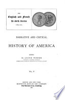
 | Justin Winsor - 1887 - 688 pagina’s
...number of fighting men according to the account of Capt. T. Nearn.' When Moll, in 1720, published his New Map of the North Parts of America claimed by France under the name of Louisiana, Mississippi, Canada, and New France, •with the adjoining territorjfs of England... | |
 | Rhodes & McClure Pub. Co., Chicago - 1888 - 412 pagina’s
...which in most instances still cling to them. The title to the old map from which I made the tracing is "a new map of the north parts of America, claimed by France under ye names of Louisiana, Mississippi, Canada and new France, with ye adjoining territories of England and Spain." Devil's Lake,... | |
 | 1927 - 848 pagina’s
...views; 1o inset charts. Colored in outline. [London, 1715]. 23 X38 in. U(6os)$2o.oo. Moll (Herman). A New Map of the North Parts of America claimed by France. Colored in outline. Inset view. London, 172o. 24x4o in. (One fold repaired). TU(1244)$17.oo. New Map... | |
 | Maryland Geological Survey - 1897 - 622 pagina’s
...Scale 200 miles to an inch. Maryland not mentioned. Virginia adjoins JC. Suede. (XJ. SGS) MOLL, H. A New Map of the North Parts of America claimed by France under ye Names of Louisiana, Mississippi, Canada and New France with ye adjoining Territories of England and Spain. The Projection... | |
 | Maryland Geological Survey - 1897 - 590 pagina’s
...symbols. Scale 200 miles to an Inch. Maryland not mentioned. Virginia adjoins N. Snede. (USGS) MOLL, H. A New Map of the North Parts of America claimed by France under ye Nanies of Louisiana, Mississippi, Canada and New France with y" adjoining Territories of England and... | |
 | Maryland Geological Survey - 1897 - 590 pagina’s
...symbols. Scale 200 miles to an inch. Maryland not mentioned. Virginia adjoins N'. Suede, a'. SGS) MOLL, H. A New Map of the North Parts of America claimed by France under ye Sanies of Louisiana, Mississippi, Canada and New France with ye adjoining Territories of England and... | |
 | Maryland Geological Survey - 1897 - 590 pagina’s
...symhols. Scale 200 miles to an Inch. Maryland not mentioned. Virginia adjoins N. Suede. (USGS) MOLL, H. A New Map of the North Parts of America claimed by France under yc Names of Louisiana, Mississippi, Canada and New France with ye adjoining Territories of England... | |
| |